Three screens. No maps. Anyone recognise this junction?
He downloaded the route. Didn’t realise the countryside was a separate purchase.
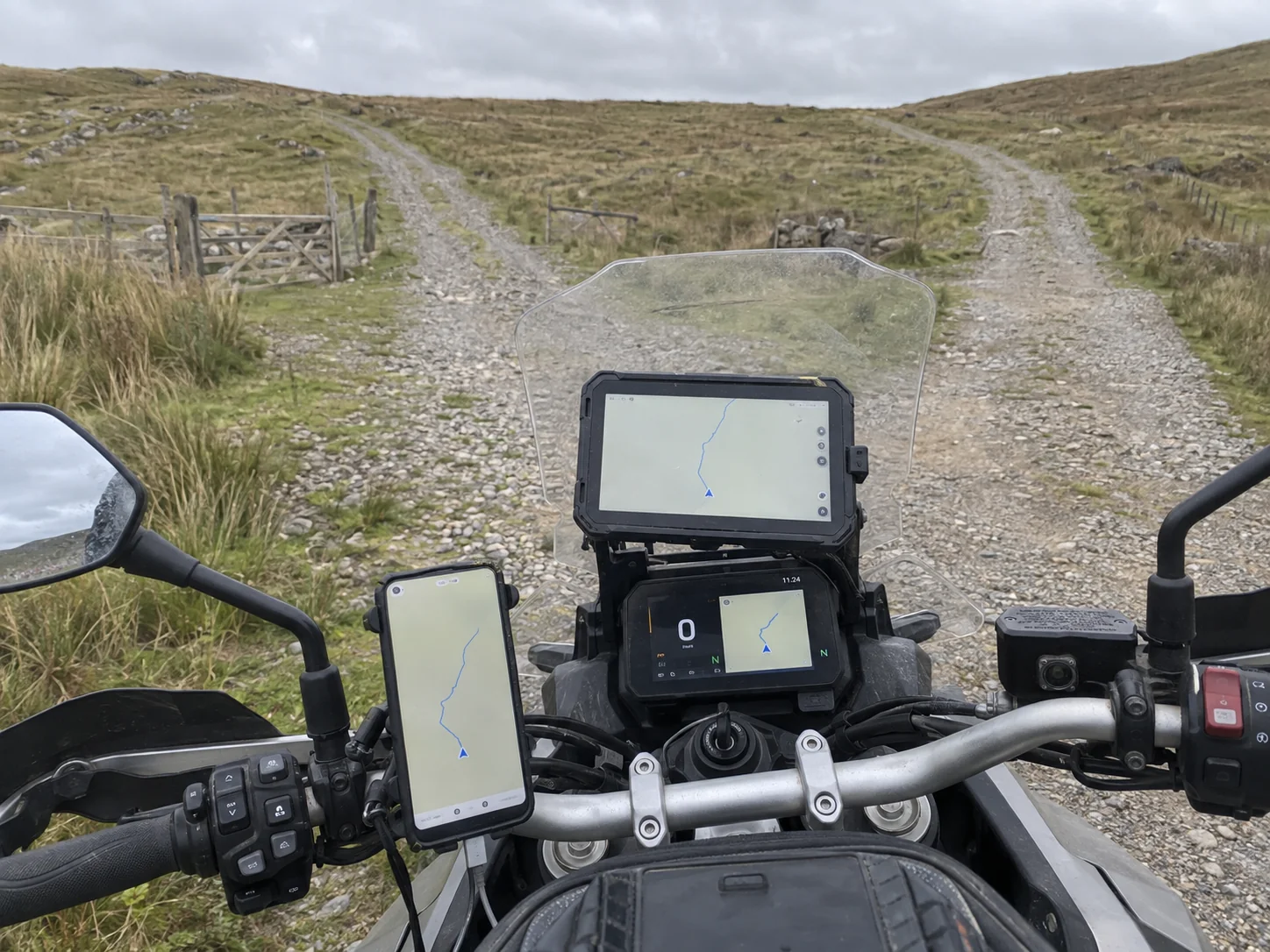
Anyone recognise this junction?
Got a dedicated navigation tablet, backup phone and the bike’s own navigation. Currently three different ways of showing me nothing.
The route is there, but the map underneath has disappeared. I’m a blue triangle in a beige area. Does anyone know which beige area this is?
Apparently I was supposed to download “offline maps”. I downloaded the route. Didn’t realise the countryside was a separate purchase.
Tested everything extensively on the drive last night and it worked perfectly. Wife’s now saying that was because I was connected to the house Wi-Fi, but she doesn’t ride.
Please don’t suggest a paper map. I spent £800 specifically to move beyond paper.
There are two tracks here. One goes uphill and the other also goes uphill but from a different angle. Photo attached. Surely someone local will know.
Managed to get enough signal to post this by walking up a bank. Can someone download the map at their house and send me a screenshot? Ideally all of Wales, but detailed enough to show this gate.
EDIT: Found the coordinates. Didn’t write them down before coming back to where the signal is.
EDIT 2: Backup phone has exactly the same problem. At least that confirms it isn’t the phone.
EDIT 3: A walker’s offered to show me where I am on his map. Will update once he’s finished unfolding it.